





GIS developer · creator of Maptor (MakanNegar) · PhD student in GIS
maptor.ir · NuGet · Google Scholar · ORCID · Stack Overflow · LinkedIn
I build spatial systems in .NET — geometry and projection engines, spatial format readers and writers, database adapters, and the map controls that sit on top of them. Most of that work goes into Maptor. Alongside it I work on backend and data engineering: ASP.NET Core APIs, ETL pipelines, and reporting on SQL Server and PostgreSQL.
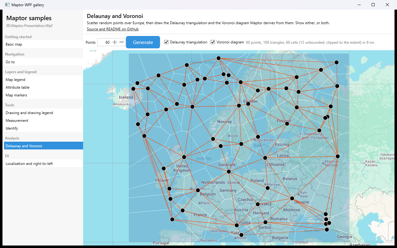
The Maptor WPF gallery — a Delaunay triangulation and its dual Voronoi diagram over Europe: 60 points, 106 triangles, 60 cells, in 9 ms.
Maptor is an open-source .NET library suite for spatial data modelling, processing and visualization. Core packages target .NET Standard 2.1, so they run cross-platform on .NET Core 3.0+ / .NET 5+; the WPF map viewer targets .NET 8 (Windows).
- Spatial reference systems — predefined ellipsoids, datum transformations, UTM / Mercator / Web Mercator / Lambert Conformal Conic, and geodetic distance on both the ellipsoid and the sphere
- Geometry and algorithms — the OGC geometry model, Delaunay triangulation, Voronoi diagrams, convex hull, line simplification, KdTree and RTree spatial indexes, graph algorithms, and machine learning for spatial data
- Formats — Shapefile, GeoJSON, TopoJSON, Esri JSON, KML/KMZ, GPX, WKT/WKB, DXF, GeoParquet, PMTiles, Mapbox vector tiles, MBTiles, GeoPackage, GeoTIFF metadata, world files, and SVG / EPS / PDF export
- OGC services — WMS, WFS, GML and SLD
- Databases — SQL Server Spatial, PostgreSQL/PostGIS, SQLite, Esri Personal Geodatabase, and EF Core spatial mapping without NetTopologySuite
- WPF visualization — an interactive
MapViewercontrol with layers, symbology, tile basemaps, markers, measurement and identify tools, and localization across 15 cultures including right-to-left


Get started · Packages · Samples gallery · Source on GitHub
As of September 2026:
- MGRS and map grids — military grid reference system support and configurable grid lines in the
MapViewer - Maptor v3 — the restructure into Core / Infrastructure / Presentation tiers, and the package rename off the older
Sta/Ket/Jabidentifiers - maptor.ir — the documentation site, samples gallery and per-package guides, in English and Persian
- PhD research in GIS — see Google Scholar and ORCID
.NET and backend





Data and storage


Data engineering and BI


Build and ship




Applied with clean architecture, domain-driven design, established design patterns, microservices, careful algorithm design, and an xUnit test suite.
- Machine learning and AI
- Real-time data streaming — Kafka, RabbitMQ
- Spatial visualization
- Concurrency — async, parallel and multithreaded programming
- Introduction to Algorithms (CLRS) — the classic algorithms reference
- Computational Geometry: Algorithms and Applications (Springer, 2008) — de Berg, Cheong, van Kreveld & Overmars
- Data Mining: Concepts and Techniques (2011) — Han, Kamber & Pei
- C# 10 in a Nutshell — the definitive reference (O'Reilly, 2022)
- C# in Depth — a deep dive into modern C# by Jon Skeet
- Concurrency in C# Cookbook — asynchronous, parallel and multithreaded programming, by Stephen Cleary
- Software Engineering: A Practitioner's Approach — Roger Pressman
- Dive Into Design Patterns (2019) — practical pattern implementations
- Unit Testing: Principles, Practices, and Patterns (Manning, 2019) — Vladimir Khorikov
- GIS: A Computing Perspective — Worboys & Duckham
- Geographic Information Analysis (2003) — O'Sullivan & Unwin
- Digital Terrain Modeling (2005) — Li, Zhu & Gold




