Python library for calculating hydroperiod (flood days) from water mask time series.
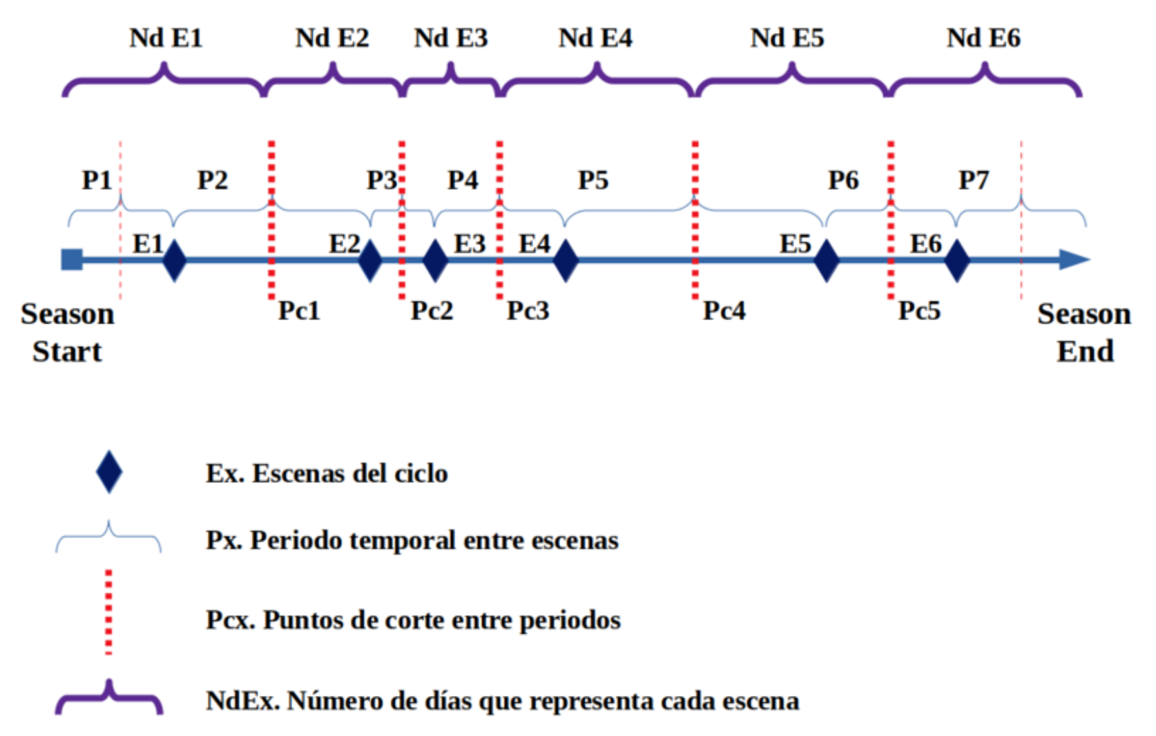
The hydroperiod calculation distributes 365 days among available scenes based on their temporal position within the hydrological cycle (September 1st - August 31st):
pip install phydroperiodFor development:
git clone https://github.com/Digdgeo/Phydroperiod.git
cd Phydroperiod
pip install -e ".[dev]"from phydroperiod import compute_hydroperiod
# Calculate hydroperiod from a directory with water masks
results = compute_hydroperiod("/path/to/water_masks")
print(f"Hydroperiod: {results['hydroperiod']}")
print(f"Valid days: {results['valid_days']}")
print(f"Normalized (0-365): {results['normalized']}")
print(f"First flood (DOY): {results['first_flood_doy']}")
print(f"First flood (date): {results['first_flood_date']}")
print(f"Last flood (DOY): {results['last_flood_doy']}")
print(f"Last flood (date): {results['last_flood_date']}")
print(f"IRT raster: {results['irt_raster']}")
print(f"IRT global: {results['irt_global']}")- Format: GeoTIFF (.tif)
- Default values: 0 = dry, 1 = water, 2 = nodata (clouds, shadows, etc.)
- Filenames: must start with date in YYYYMMDD format (e.g.,
20200915_flood.tif)
Values are configurable:
Complete pipeline that executes all processing steps:
from phydroperiod import compute_hydroperiod

# Basic usage (default values: 0=dry, 1=water, 2=nodata)
results = compute_hydroperiod(
    input_path="/path/to/masks",
    output_path="/path/to/output",  # optional
    normalize=True,  # generates hydroperiod normalized to 365 days
)

# With custom values
results = compute_hydroperiod(
    input_path="/path/to/masks",
    water_value=1,      # value representing water
    dry_value=0,        # value representing dry land
    nodata_value=255,   # value representing nodata
)from phydroperiod import (
calculate_scene_weights,
process_masks,
accumulate_hydroperiod,
normalize_hydroperiod,
calculate_first_last_flood,
calculate_temporal_representativity,
calculate_pixel_irt,
)
# 1. Calculate weights per scene (includes day ranges)
weights = calculate_scene_weights(mask_files)
# 2. Process masks (generates intermediate products)
intermediate_dir = process_masks(input_path, weights=weights)
# 3. Accumulate total hydroperiod
hydroperiod_path, valid_days_path = accumulate_hydroperiod(intermediate_dir)
# 4. Normalize to 365 days (saved as integer)
normalized_path = normalize_hydroperiod(output_path)
# 5. Calculate first/last flood day per pixel (DOY and YYYYMMDD formats)
flood_dates = calculate_first_last_flood(input_path, weights=weights)
# 6. Calculate Temporal Representativity Index (global and per-pixel)
irt_global = calculate_temporal_representativity(mask_files)
irt_raster = calculate_pixel_irt(input_path)The calculation is based on the hydrological cycle running from September 1st to August 31st of the following year. Each scene receives a proportional weight based on its temporal position within the cycle.
| File | Description |
|---|---|
*_flood_rec.tif |
Flood days per scene (intermediate) |
*_dry_rec.tif |
Dry days per scene (intermediate) |
*_valid_rec.tif |
Valid days per scene (intermediate) |
hydroperiod_YYYY_YYYY+1.tif |
Accumulated hydroperiod (integer) |
valid_days_YYYY_YYYY+1.tif |
Accumulated valid days (integer) |
hydroperiod_nor_YYYY_YYYY+1.tif |
Normalized hydroperiod (0-365, integer) |
first_flood_doy_YYYY_YYYY+1.tif |
First flood day (0-365, day of hydrological year) |
last_flood_doy_YYYY_YYYY+1.tif |
Last flood day (0-365, day of hydrological year) |
first_flood_date_YYYY_YYYY+1.tif |
First flood day (YYYYMMDD format, e.g., 20240915) |
last_flood_date_YYYY_YYYY+1.tif |
Last flood day (YYYYMMDD format, e.g., 20250213) |
irt_YYYY_YYYY+1.tif |
Temporal Representativity Index per pixel (0-1) |
The library calculates an index (0-1) that measures how well distributed the observations are throughout the hydrological year:
- IRT = 1: Observations perfectly distributed across the year
- IRT = 0: All observations concentrated in a single period
Two IRT values are provided:
- Global IRT (
irt_global): Based on the available scenes, same for all pixels - Per-pixel IRT (
irt_raster): Accounts for nodata (clouds, shadows) affecting each pixel differently. A pixel covered by clouds in summer will have lower IRT than one with observations throughout the year.
This helps assess the reliability of the hydroperiod calculation at both collection and pixel level.
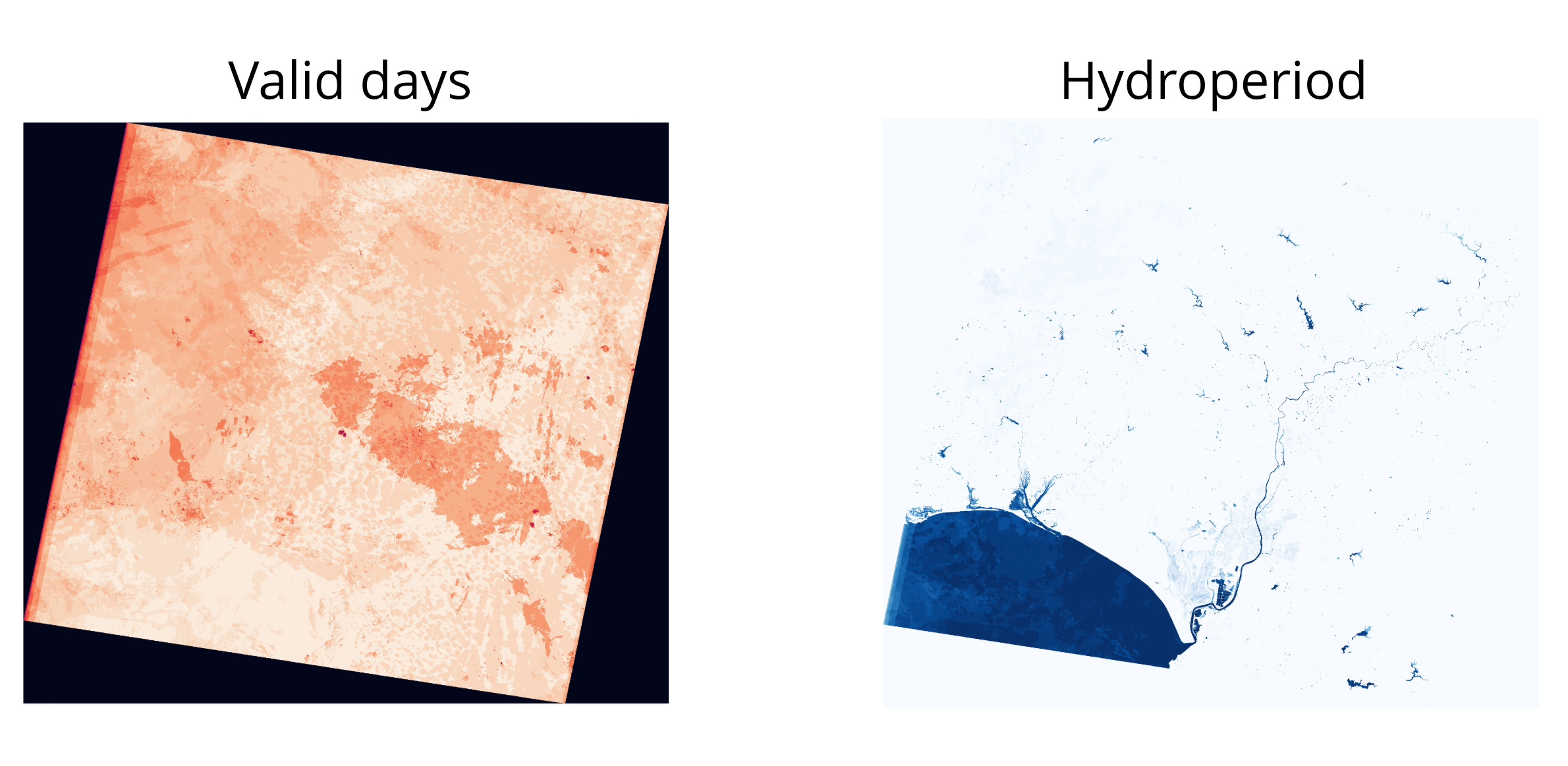 Accumulated valid days (left) and non-normalized hydroperiod (right) for the 2023-2024 hydrological cycle in Doñana, Spain.
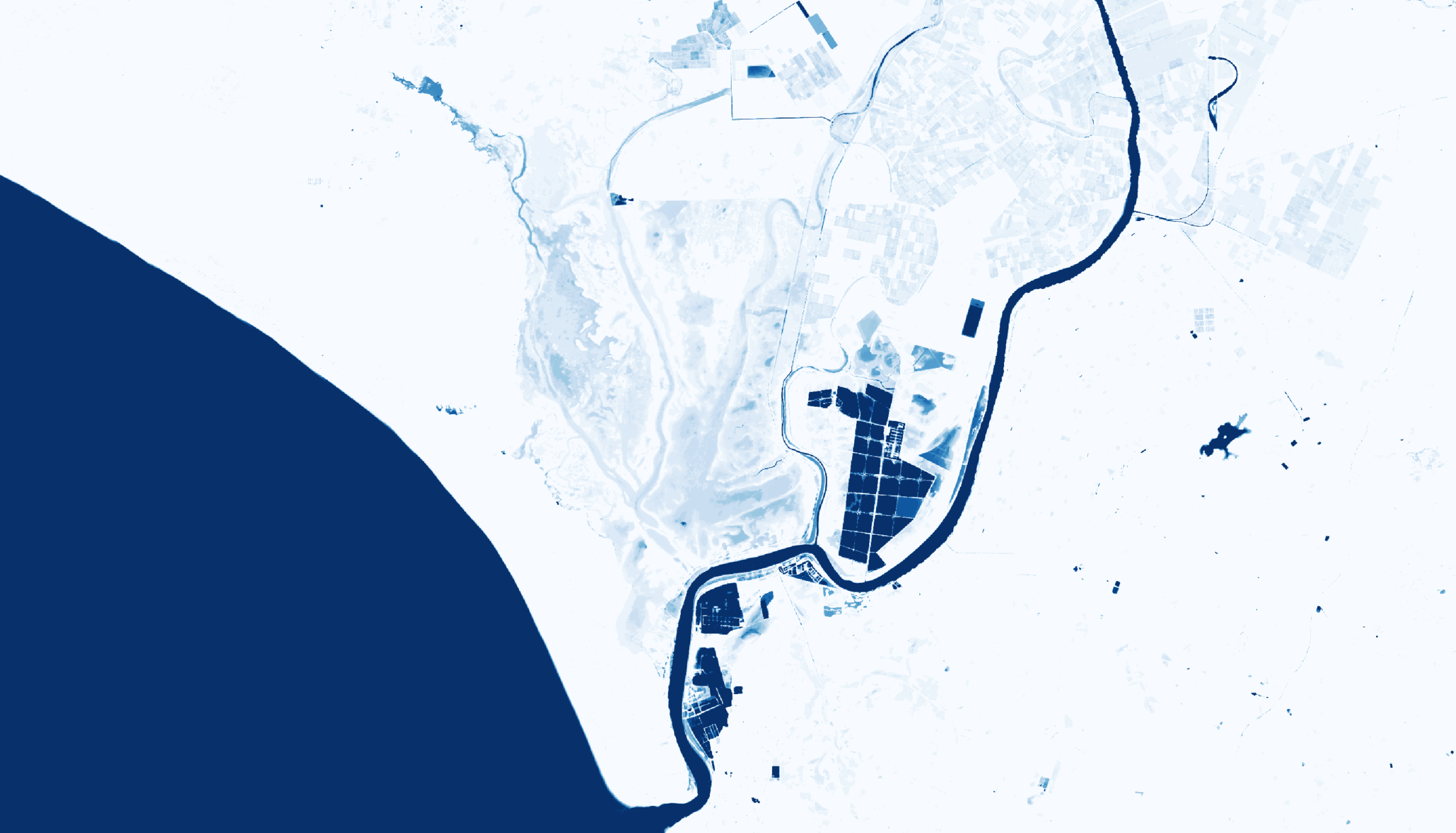 Normalized hydroperiod (0-365 days) for the same cycle.
- Google Earth Engine integration for water mask retrieval
- Ndvi2Gif integration for automatic mask generation
- CLI for terminal usage
- Support for multiple hydrological cycles
- Leafmap integration for interactive visualization
- Diego García Díaz - Development, implementation, and methodology
- Javier Bustamante Díaz - Core methodology
MIT